Reservoir@ Campbell down to Penticton
Page 1 of 1
 Reservoir@ Campbell down to Penticton
First off, let me just say this was NOT a bike ride but more of a hike while carrying a 40lb bike. For some reason I thought I could find a game trail that led through the canyon from Campbell's and pop out at the treatment plant on the end of Penticton Ave.
Fail.
Epic fail.
Most epic fail in the history of bad ideas.
Full Album
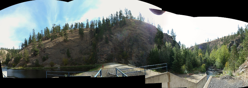
The plan started out as a way to connect Code4 into Campbell because the rancher's pass through there 'somewhere' and we wanted a connector. From above, looking down at the reservoir, you can see game trails heading up.

The ride down the cattle switchbacks was interesting, if not a little hairy with the 6" round rocks rolling away from under me dropping down the straight hillside to my left/right/left/right/left (5 switchbacks).

I discovered some interesting things, some disturbing and others more cowboyish (from what I can only imagine) but most likely more hobo / frenchy.
Grave?

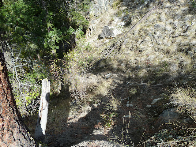
I came across a 'heavy game' trail, most likely cattle, leading up the east bank. This is far too steep to ride comfortably, but a switchback would be possible and probably enjoyed by the original creators.

View from above (sorry for the poor shadows)
Trail continues on out into the great brown yonder
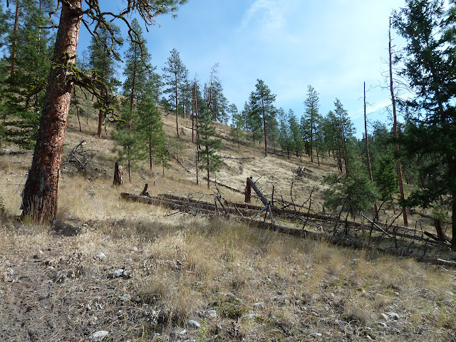
Now this is where my thought process went askew. Taking into consideration that I had to be home by 3 for thanksgiving dinner and it was now noon, I decided against venturing into the western hillside that had an undetermined exit, and headed into the abyss that lead straight back to town.
I managed to cross the creek here with nary a drop of water on my shoes.
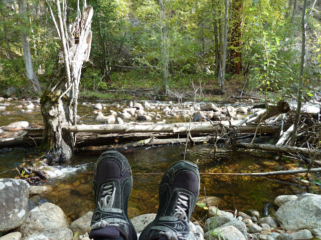
This may be the giant log that was launched off the side of Campbell by couple of riders (you know who you are)
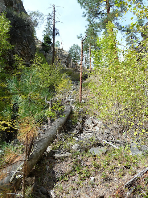
Some resourceful beavers are now using out garbage to build lodges and damns. I have to thank them too, because it sure made crossing easier, although I was a little concerned about hauling a bike across it and them coming out and attacking me.

I believe this is the canyon trail, I haven't plugged my gps in yet because of hardware issues. I'll get the course log on soon. The camera's gps paints a fair picture though.

??? I'm gonna guess ... drug haven. This location gave me copious amount of hope for a trail. Later I realized it was yet another event on national epic fail day. In my ignorance, I left them a little note spelled in rocks, just to let them know I was there.
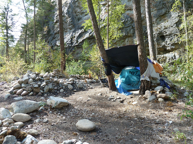
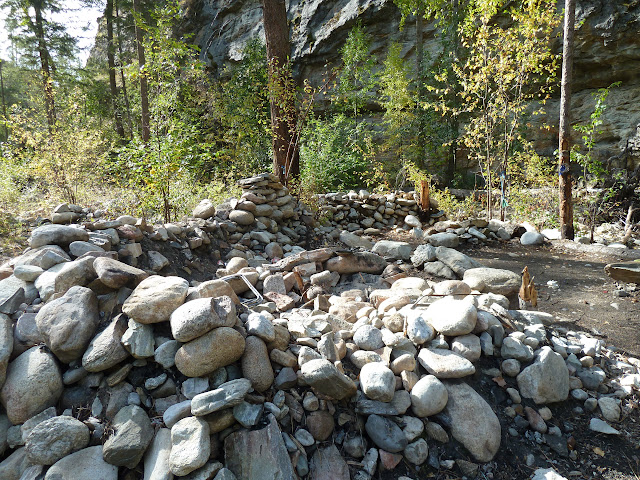
A ridiculous amount of rock work done, I'm not sure what its purpose is but I can only imagine it is a water retention barrier.
Really??? Who hikes this fair with spray paint??

It is around this point where I've given up rock hopping to cross the creek. After 4 dry crosses that consumed way too much time. I just drove on through the water, sure it was cold and mildly dis-concerning, but the stress of balancing on slime river rock with cleated bike shoes and no cell service made dry feet not worth the effort. Promptly after dunking my feet I found that frozen legs (yes, I wore shorts, just another example of my ignorance) are greatly effected by the stinging razors of low lying shrubbery.
An old water testing or pump shack?
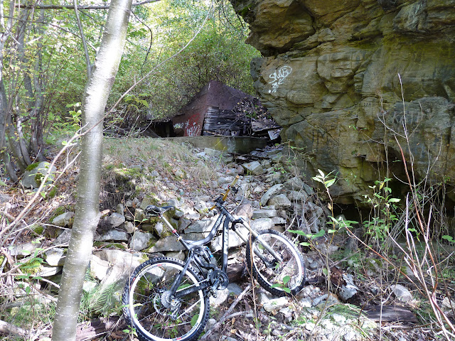
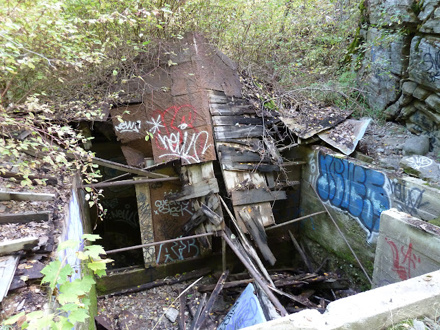
Humbling.
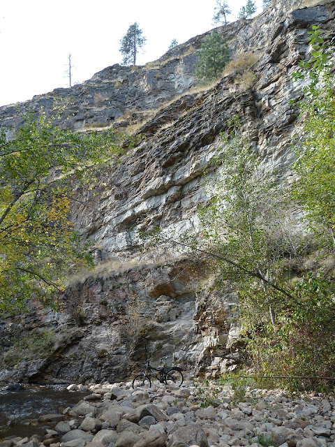
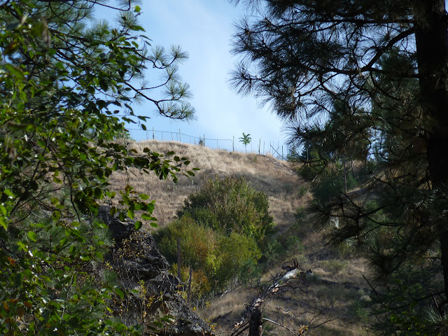
If you look through the trees, there is a fence line. That gave me hope.
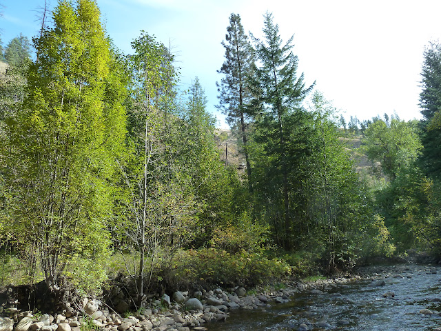
Found a car down the bank, it was flagged so I knew there was nothing cool left in it. But it gave me hope of a road nearby.
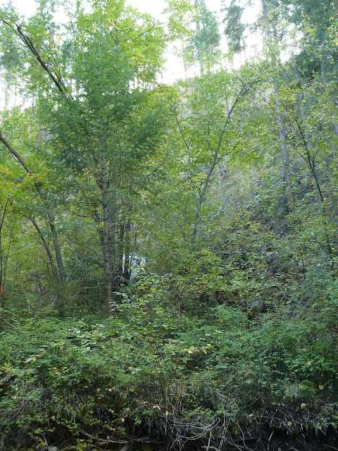
Classy. Really makes me proud of our kids. (that was sarcasm)
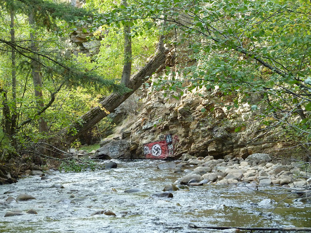
Especially this one, I'm talking about you Nathan Hoy from 2011.
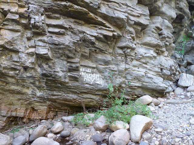
With the increased level of graffiti, I knew I was approaching civilization as most kids now a days are too lazy to make it around the block to do useless destruction and general no-goodness.
This was another place of bitter disappointment. When I made it to the reservoir, I found a two track leading up a hill. I thought I was saved by a road. Fighting my way up this seemingly vertical track, I finally summitted only to find a 8 foot barbed wire fence with massive locks. I stopped for a cry and a photo. The old switch-backs up behind Pleasant Valley, I'm guess few riders see them from this angle.

What you are drinking ... guess what I did

Hardest part of the entire trip, climbing this fence on an completely eroded 15% slope with a 40lb bike.

And what do I have to show for it other than a bike that has more creaks than my knees in the morning?
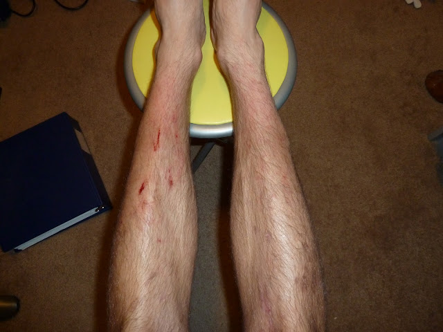
Who wants to join me on another adventure? I want to bike from the Garnett Fire parking to the bottom of Ellis Canyon. Bring a rope.
Fail.
Epic fail.
Most epic fail in the history of bad ideas.
Full Album
The plan started out as a way to connect Code4 into Campbell because the rancher's pass through there 'somewhere' and we wanted a connector. From above, looking down at the reservoir, you can see game trails heading up.
The ride down the cattle switchbacks was interesting, if not a little hairy with the 6" round rocks rolling away from under me dropping down the straight hillside to my left/right/left/right/left (5 switchbacks).

I discovered some interesting things, some disturbing and others more cowboyish (from what I can only imagine) but most likely more hobo / frenchy.
Grave?
I came across a 'heavy game' trail, most likely cattle, leading up the east bank. This is far too steep to ride comfortably, but a switchback would be possible and probably enjoyed by the original creators.
View from above (sorry for the poor shadows)
Trail continues on out into the great brown yonder
Now this is where my thought process went askew. Taking into consideration that I had to be home by 3 for thanksgiving dinner and it was now noon, I decided against venturing into the western hillside that had an undetermined exit, and headed into the abyss that lead straight back to town.
I managed to cross the creek here with nary a drop of water on my shoes.
This may be the giant log that was launched off the side of Campbell by couple of riders (you know who you are)
Some resourceful beavers are now using out garbage to build lodges and damns. I have to thank them too, because it sure made crossing easier, although I was a little concerned about hauling a bike across it and them coming out and attacking me.
I believe this is the canyon trail, I haven't plugged my gps in yet because of hardware issues. I'll get the course log on soon. The camera's gps paints a fair picture though.
??? I'm gonna guess ... drug haven. This location gave me copious amount of hope for a trail. Later I realized it was yet another event on national epic fail day. In my ignorance, I left them a little note spelled in rocks, just to let them know I was there.
A ridiculous amount of rock work done, I'm not sure what its purpose is but I can only imagine it is a water retention barrier.
Really??? Who hikes this fair with spray paint??
It is around this point where I've given up rock hopping to cross the creek. After 4 dry crosses that consumed way too much time. I just drove on through the water, sure it was cold and mildly dis-concerning, but the stress of balancing on slime river rock with cleated bike shoes and no cell service made dry feet not worth the effort. Promptly after dunking my feet I found that frozen legs (yes, I wore shorts, just another example of my ignorance) are greatly effected by the stinging razors of low lying shrubbery.
An old water testing or pump shack?
Humbling.
If you look through the trees, there is a fence line. That gave me hope.
Found a car down the bank, it was flagged so I knew there was nothing cool left in it. But it gave me hope of a road nearby.
Classy. Really makes me proud of our kids. (that was sarcasm)
Especially this one, I'm talking about you Nathan Hoy from 2011.
With the increased level of graffiti, I knew I was approaching civilization as most kids now a days are too lazy to make it around the block to do useless destruction and general no-goodness.
This was another place of bitter disappointment. When I made it to the reservoir, I found a two track leading up a hill. I thought I was saved by a road. Fighting my way up this seemingly vertical track, I finally summitted only to find a 8 foot barbed wire fence with massive locks. I stopped for a cry and a photo. The old switch-backs up behind Pleasant Valley, I'm guess few riders see them from this angle.
What you are drinking ... guess what I did

Hardest part of the entire trip, climbing this fence on an completely eroded 15% slope with a 40lb bike.
And what do I have to show for it other than a bike that has more creaks than my knees in the morning?
Who wants to join me on another adventure? I want to bike from the Garnett Fire parking to the bottom of Ellis Canyon. Bring a rope.

1part@atime- Posts : 218
Join date : 2009-06-21
Age : 45
Location : Penticton

1part@atime- Posts : 218
Join date : 2009-06-21
Age : 45
Location : Penticton
 Similar topics
» Jose's via Reservoir
» Water reservoir above the Mice on Friday?
» Pearly Gate to Reservoir - Tripod to TsweetTsu
» Penticton to Oliver
» any DH trails in Penticton?
» Water reservoir above the Mice on Friday?
» Pearly Gate to Reservoir - Tripod to TsweetTsu
» Penticton to Oliver
» any DH trails in Penticton?
Page 1 of 1
Permissions in this forum:
You cannot reply to topics in this forum